A carefully planned superyacht visit to California’s Channel Islands reveals extraordinary wildlife and coastal heritage, with weather, landing permits and marine reserves setting the rules.
A Californian superyacht destination that rewards restraint
The five islands of Channel Islands National Park sit within reach of Southern California, yet their appeal has little in common with the spectacle of a marina promenade. Here the luxury is space, natural history and the chance to experience the Pacific on its own terms. For a superyacht, the islands can form an exceptional offshore chapter after a mainland stay, provided the captain treats landing permissions, weather and ecological restrictions as the central organising principles. They are not a chain of purpose-built superyacht anchorages, and the experience should never be marketed as though they were.
Anacapa, Santa Cruz, Santa Rosa, San Miguel and Santa Barbara offer contrasting shorelines, sea cliffs, wildlife and cultural histories. The National Park Service identifies the islands as a destination for experienced private boaters, but expressly warns that the channels contain shifting swells, currents, fog, strong winds and busy commercial shipping lanes. The contrast is part of the destination's character: a calm morning can reveal immense coastal beauty, while a deteriorating forecast can make a landing wholly inappropriate. A good itinerary therefore reserves freedom to change plans rather than treating a rigid timetable as a measure of service.
Where to begin: Ventura, Santa Barbara and passage planning
A mainland staging point around Ventura or Santa Barbara gives the bridge team an opportunity to study the official nautical charts, notices to mariners and current marine forecast before the first crossing. The park references NOAA chart numbers 18720, 18721, 18725, 18727, 18728, 18729 and 18756; those references help identify the appropriate chart portfolio but do not replace corrected electronic and paper navigation material. The vessel's draft, anchor gear, tender arrangements, fuel endurance and exposure limits should all be assessed before guests see a proposed shore schedule.
The National Park Service warns that major shipping lanes between the mainland and islands require particular attention, and that fog can substantially reduce visibility. Navigational watchkeeping, AIS and radar practice matter even when the destination appears close on a map. A formal float plan and clear emergency contacts are sensible operational safeguards. Captains should monitor official marine warnings and the Coast Guard's notices, not assume that a favourable harbour forecast predicts conditions beside the islands. The park notes that August through October often offer relatively calm conditions, but strong winds can occur in any season.
The decisive limitation is the absence of public moorings and reliable all-weather anchorages. Both the National Park Service and NOAA's Channel Islands sanctuary guidance advise leaving a capable person aboard when a landing party goes ashore. The superyacht may provide comfort, equipment and range, but none of those assets creates shelter where the geology has not provided it. Anchor choice, holding ground, swing circle and possible swell reversal deserve a specific plan for every stop; if the plan is weak, the correct luxury decision is to move on.
Santa Cruz: Prisons Harbor, Scorpion and island history
Santa Cruz is the most varied option for an island day, combining protected heritage landscapes with dramatic coastal scenery. The National Park Service describes visitor access to its eastern section, including the familiar arrival areas of Scorpion Anchorage and Prisoners Harbor. These names should not be mistaken for guaranteed yacht berths. Park-service piers and restricted buoys are not generally available for visiting private vessels, and disembarkation may require a carefully supervised tender operation appropriate to the actual swell and prevailing restrictions.
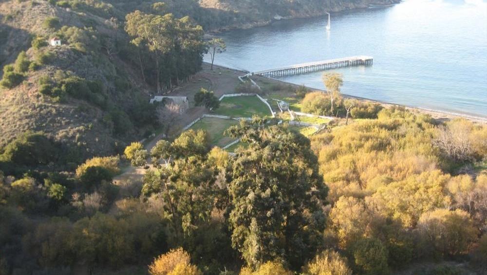
Prisoners Harbor offers an unusually meaningful shore experience when access is authorised and conditions permit. The harbour's cultural landscape records centuries of human occupation and later ranching, while a wetland restoration project illustrates how the park is attempting to repair ecological systems affected by past land use. An NPS image of the harbour accompanies this guide. Visitors can appreciate the coastal setting without assuming that every trail is open, and a guided interpretation of the island's Chumash history and subsequent ranching era adds perspective beyond a quick scenic photograph.
At Scorpion, the setting changes again: cobble beaches, kelp forest and coastal cliffs create the appeal for snorkelling and kayaking. The park calls attention to the shoreline's sea caves, but it also warns that swell can flood a cave without warning. Sea-cave exploration should be led by appropriately trained people in suitable conditions and equipment. Guests should not step onto rock ledges inside caves, touch wildlife, or mistake a tender for an unrestricted sightseeing licence. For a superyacht party, a safe, modest excursion can be far more rewarding than a risky attempt to reach every cove.
Anacapa, Santa Rosa and the less forgiving western islands
Anacapa's high profiles and seabird habitat create an evocative silhouette from the sea. The permitted visitor landing on East Anacapa is at Landing Cove, and the park makes clear that local moorings are reserved for authorised operations. West and Middle Anacapa have much tighter access rules, including closures intended to protect nesting wildlife. A tender excursion that remains outside restricted areas can still yield a memorable view of rock, ocean and birds; the ability to approach an island does not itself confer the right to step ashore.
Santa Rosa offers a different rhythm, with exposed beaches, natural history and substantial distances between visitor areas. The NPS identifies a seasonal closure of back beaches and dunes between Skunk Point and near East Point to protect snowy plovers, while beaches around Sandy Point are closed year-round. A guest programme that arrives with flexibility can respect these limits and choose a lawful route; one that assumes an open beach is a landing beach risks disturbance and disappointment. In conservation destinations, access is a privilege that must be verified on the day.
San Miguel is the more demanding proposition, exposed to the full influence of the Pacific. The park identifies Cuyler Harbor and Tyler Bight as the restricted overnight anchoring options, and explains that the island is owned by the US Navy and has a history as a bombing range. Landing and walking have special requirements, including a waiver and ranger arrangements. This is not an independent beach stop for an unbriefed tender. Santa Barbara Island likewise has a defined landing cove, with loading arrangements that should not be confused with overnight mooring permission.
Charter yachts, commercial authorisation and protected waters
An important operational distinction is whether the vessel is on a private owner voyage or conducting a commercial guest operation. The National Park Service maintains a commercial-use authorisation programme and publishes vessel-based landing restrictions for authorised operators. Its guidance limits the landing locations and may condition them on concessioner schedules and the season. A charter manager or captain must determine which permissions apply to the proposed operation before selling or promising a guided island landing, and cannot simply assume that the rules for a privately operated yacht cover a paid excursion.
The protected marine environment imposes responsibilities beyond the shoreline. NOAA's Channel Islands National Marine Sanctuary publishes a network of marine reserves and conservation areas, some of which prohibit taking natural resources or require fishing gear to be stowed. Different zones have different rules. The bridge team should use the current official boundaries and regulations when planning fishing, diving or tender routes, rather than extrapolating from a generic map of the park. NOAA also cautions against damaging the seabed and describes restrictions on discharge and personal watercraft.
The park's rules prohibit pets on the islands and restrict personal watercraft in park waters. Offshore rocks and small islets are not casual landing platforms, and closed nesting habitats should be respected even when wildlife is difficult to see. Guests should be briefed before launching tenders: keep a respectful distance from seals and seabirds, leave shells and archaeological objects where they are, and return with every item of rubbish. These points are practical hospitality, not a lecture. A yacht that visits quietly helps preserve the reason its guests came.
Designing a two-day experience worth remembering
A sensible first day begins with a mainland departure only after a fresh weather and vessel briefing. If the prevailing conditions and legal access permit, Santa Cruz can provide the principal encounter, with a small-group cultural walk or natural-history visit ashore and a slower afternoon devoted to observing the coastline from the yacht. The second day might favour distant views and wildlife watching around Anacapa, or another permitted location chosen after checking forecasts, closures and available personnel. There is no virtue in forcing a second landing merely to complete an itinerary.
Meals and guest activities can reflect the Pacific setting without staging anything that disturbs the park. A California seafood menu from responsibly sourced ingredients, interpretation by a qualified naturalist and careful photography from a respectful distance may offer more depth than motorised toys. When the sea allows, a quiet paddle in an authorised, appropriate area can be memorable; when it does not, the best alternative may be a comfortable cruise with binoculars and a knowledgeable guide. The day should be paced around wildlife and safety rather than a sequence of fixed entertainment slots.
The most polished Channel Islands cruise is therefore one whose invisible work is substantial: bridge research, corrected charts, environmental briefings, tender drills, commercial permissions where applicable and conservative weather decisions. That preparation lets guests focus on the sensory experience of islands rising from the Pacific and on the fact that this remains protected, living coastline. A superyacht can bring exceptional comfort to the Channel Islands, but the landscape itself sets the terms of the visit.
Official planning references
Before departure, consult the National Park Service's Channel Islands boating, permits and laws pages and NOAA's Channel Islands National Marine Sanctuary guidance on responsible boating and marine reserves. Rules, closures, weather and authorisation arrangements change, and this feature is an editorial planning overview rather than a chart, permit or navigation instruction. Official references: NPS boating guidance; NPS permits; NPS commercial-use authorisations; NOAA responsible boating; NOAA marine reserves. Hero photograph: Prisoners Harbor, National Park Service, public-domain NPS photo.