A considered superyacht shore guide to Christiansted, St Croix: explore Fort Christiansvaern, the historic port's Danish-era buildings, the realities of its sugar economy, and practical visits.
A shoreline that explains the island's maritime history
Christiansted rewards the yacht traveller who wants a port to mean more than a picturesque arrival. The waterfront of this St Croix town tells a complicated story of ships, sugar, imperial administration and human lives. Its central landmark, Fort Christiansvaern, is part of a compact National Park Service site where several surviving buildings show how a Caribbean harbor was organised and controlled. This is a shore experience best approached with time to read, reflect and look carefully, rather than as a hurried photo stop.
From the water, the historic center has an unusual clarity: fortifications, government buildings and commercial streets sit close together because the harbor shaped the settlement. A guest can arrive expecting attractive Danish-era architecture and leave with a much richer understanding of what paid for it. The historical landscape is also a reminder that a trading port can be simultaneously a place of enterprise, cultural exchange, forced labor and resistance. Those connections make Christiansted a particularly worthwhile destination for interested yacht owners and guests.
Fort Christiansvaern: built to watch the harbor
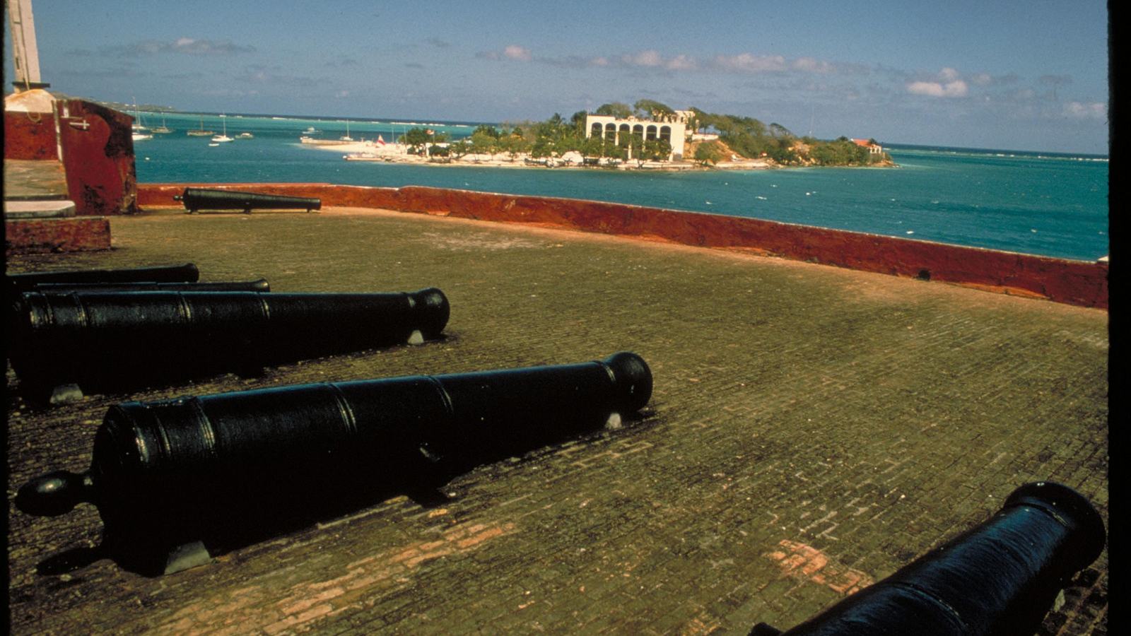
The fort stands above Christiansted Harbor, its yellow brickwork visually distinct from the town behind it. According to the National Park Service, construction of the surviving fort began in 1738 after an earlier fortification on the same site was destroyed in a hurricane. The principal structure was completed by 1749 and additions followed in the nineteenth century. Bricks brought from Denmark as ships' ballast became building material for a defensive complex on the Caribbean shore.
Its purpose was inseparable from maritime commerce. Defending ships against pirates and privateers mattered, but so did enforcing customs duties and maintaining colonial authority. The NPS also identifies the quartering of troops tasked with suppressing potential uprisings by enslaved people as a central function. Looking at the guns, walls and sightlines without that context misses the fort's deeper significance. The harbor panorama is beautiful; the institution that controlled it was part of a violent plantation economy.
Inside the fort: architecture with difficult stories
A self-guided exploration allows visitors to consider both the military design and the domestic spaces within the walls. Fort Christiansvaern housed governors and later the commandant and his family, so its rooms were not simply defensive positions. The NPS has restored the building to evoke its use as a military establishment during the 1830s and 1840s. Visitors should allow enough time to pause at interpretation rather than treating every room as a backdrop for photography.
After 1878 the fort was used as a police station and courthouse, adding another layer of civic history to an already complicated structure. That later function is easy to overlook when focusing only on cannons and ramparts. The more interesting question is how a building initially constructed to protect a colonial trading system acquired new uses as the island changed. Seeing the fort in that longer sequence brings its architecture to life without romanticising the power it once represented.
Follow the waterfront beyond the battlements
The historic site extends across roughly seven acres of the old waterfront and includes a remarkable cluster of buildings associated with administration, trade and measurement. The former Danish Customs House recalls the collection of duties on goods moving through the port. The Scale House reflects the practical business of weighing export commodities, including sugar and rum. Both make sense of the harbor as a place where cargo was counted and valued as carefully as ships were watched.
Nearby, the Danish West India and Guinea Company Warehouse gives the commercial story a darker center. The National Park Service explains that its yard was used for auctions of enslaved people. It is important to say this plainly: the prosperity associated with the Danish colonial town was produced through exploitation, not merely through an abstract 'sugar trade'. Christiansted is especially powerful because surviving spaces allow visitors to confront those facts within walking distance of the waterfront that connected the island to Atlantic markets.
The Steeple Building and the shape of the old town
The Steeple Building began as a Lutheran church and was completed in the eighteenth century, with its steeple added later. It offers another perspective on the town: alongside soldiers, merchants and officials were communities worshipping, working and navigating daily life. Street alignments and adjoining buildings help explain why Christiansted can feel more coherent than a collection of isolated monuments. The buildings belong to a designed port settlement, and their positions reveal the administrative priorities of its founders.
The NPS traces Christiansted's establishment to the 1730s after Denmark acquired St Croix from France. The town developed near a sheltered, reef-protected harbor valued by earlier European occupiers as well. Those layers make a walking tour more revealing than a single-building visit. History is visible not only in an old wall or a dated doorway, but in the spatial relationship between the quay, government premises, warehouse, church and streets serving the trading community.
Sugar, shipping and the lives behind the wealth
The eighteenth- and nineteenth-century economy of St Croix was tied to plantation-grown sugar and related products carried abroad by sea. The port exported sugar, molasses and rum while receiving goods and people from across the Atlantic. This activity created an outward appearance of prosperity and a cosmopolitan harbor, yet the wealth relied heavily on the forced labor of enslaved Africans and their descendants. Visitors should keep those human stories central when reading displays about cargo volumes, trading companies and architecture.
The history did not end with the fort's completion. The National Park Service places emancipation in 1848 among the changes that transformed the island's economy, alongside shifting markets, hurricanes and droughts. Danish rule eventually ended with the 1917 transfer of the islands to the United States. A thoughtful shore day should resist compressing all those changes into a simple colonial postcard. The buildings survive because people preserved them; the purpose of the visit is to understand the lives and systems associated with them.
Arriving by yacht: clearance and landing come first
Christiansted looks immediately accessible from the harbor, but yacht access is a separate operational question from access to the historic site. The Virgin Islands Port Authority directs foreign pleasure craft entering the US Virgin Islands to designated ports for US Customs and Border Protection clearance, and lists Gallows Bay on St Croix among its clearance points. The captain and local agent should verify the vessel's circumstances, required formalities, current operating hours and the appropriate berth or approved tender landing before guests set off.
Do not assume that the waterfront in front of the fort is a freely available superyacht berth, anchorage or tender dock. Navigation, local depth, reef conditions, port traffic and permitted landing arrangements must be addressed through current charts and the relevant authorities. Once the vessel's shore transfer is properly organised, the historic buildings form a convenient focus for a land-based visit. That distinction is valuable for both comfort and compliance: the fort is a cultural destination, not a marine clearance facility.
Plan a shore excursion around the actual opening information
The National Park Service currently lists Fort Christiansvaern as open daily from 8:30 a.m. to 4:30 p.m., while its welcome center and bookstore have more limited listed hours. It also identifies Thanksgiving Day and Christmas Day as closure dates. These details can change, especially around public holidays, adverse weather or temporary conservation work, so the yacht's concierge should verify the park notice shortly before confirming the excursion.
The NPS fee page describes an adult entrance ticket of US$10 valid for three days, with children under 16 admitted free alongside an adult, subject to the park's published pass conditions. Treat this as practical pre-visit guidance rather than a guaranteed future tariff. Allow a meaningful window for the fort itself, then add time for the surrounding waterfront buildings and unhurried walking. Guests with limited mobility should ask the park about conditions in an eighteenth-century defensive building before finalising the route.
A shore day with structure rather than haste
One sensible approach is to begin at the fort while the day is cooler and attention is fresh. Read the introductory interpretation first, then follow the interior rooms, courtyard and defensive viewpoints at a deliberate pace. Afterward, trace the surviving customs and trading buildings along the waterfront and pause to consider how their functions were connected. That sequence gives physical meaning to the history: defence and colonial rule at one end, handling cargo and extracting value at the other.
For a longer excursion, leave room to explore Christiansted's historic streets and arrange refreshments independently of the park visit. A privately organised guide with sound local historical knowledge can add context, but the NPS's self-guided materials remain a useful factual foundation. The aim need not be to tick off every building. It may be more rewarding to study several places carefully, especially where accounts of enslaved people, colonial officials, sailors and residents intersect, and let the conversation continue back on board.
Why Christiansted belongs on a discerning itinerary
For a superyacht itinerary, not every exceptional shore day requires a secluded beach or a difficult transfer. Christiansted offers something harder to reproduce: an unusually legible relationship between maritime geography and the history of an entire island. The harbor that now welcomes visitors once linked St Croix to an Atlantic network in which commercial ambition, political control and enslavement were closely intertwined. The fort and waterfront buildings keep that relationship visible.
The best experience combines operational planning with intellectual curiosity. Use official port and customs advice for the yacht, rely on the National Park Service for on-site opening and interpretation, choose a properly authorised landing, and give the historic landscape time to speak. With those elements in place, Christiansted becomes more than an attractive Caribbean stop. It becomes a serious, memorable account of what harbors have meant to the people who lived and worked around them.