Alaska’s Glacier Bay rewards a carefully planned superyacht expedition, with protected wildlife, seasonal permits and the extraordinary theatre of tidewater glaciers.
A wild destination that begins with the voyage
Glacier Bay in southeast Alaska is among the rare superyacht destinations where the most memorable luxury is the absence of infrastructure. Deep fjords, wooded shorelines, tidewater ice and exceptionally quiet water reward a patient itinerary, but they also demand a captain’s discipline. This is a protected national park, not an open-access scenic marina, and its operating rules influence the route long before guests step aboard.
The waterway forms part of Glacier Bay National Park and Preserve, a UNESCO-listed landscape shaped by changing ice and the living culture of the Huna Tlingit. For owners accustomed to reserving a berth and a waterfront restaurant, the experience requires a different approach: build flexibility around weather, wildlife and permits. The purpose of a visit is to experience the environment without reducing its space, silence or resilience for others.
Private-yacht permits must come before the itinerary
The U.S. National Park Service says private boaters need an entry permit for Glacier Bay park waters north of the Point Gustavus–Point Carolus line from 1 June through 31 August. The agency piloted a new online permit process in 2026, with account creation, lottery steps and confirmation requirements. A captain planning a 2027 summer programme should check the live portal for that season’s rules rather than assuming the 2026 process or timetable will remain unchanged.
The park also requires a boater orientation each year, undertaken at the Visitor Information Station in Bartlett Cove, with permit conditions acknowledged in person. On a superyacht with a relief master or rotating bridge team, the management plan needs to identify who will actually operate the vessel in the park and who has completed the required steps. Booking an impressive offshore yacht is not a substitute for being admitted to protected waters.
The boundary and communications are operational matters
Between 1 May and 30 September, vessels entering or leaving the defined Glacier Bay waters must report to KWM20 Bartlett Cove by VHF or use the park’s published telephone contact. The park describes separate position-reporting requirements around Bartlett Cove itself, which may mean more than one call during arrival and departure. Limited cellular coverage makes a working marine radio and an agreed communication sequence especially important.
A prudent bridge plan marks the park boundaries on the electronic chart and references the NPS maps before the first inward passage. The captain should brief the watch on reporting points, the anchoring approach, the intended stop at Bartlett Cove and the possibility of temporary restrictions. Wildlife closures can change during a season, so a static itinerary circulated months earlier is never the final navigational authority.
Whales set the pace
Glacier Bay is an important feeding area for humpback whales, and special Whale Waters rules are central to a safe passage. In designated lower-bay waters, vessels over 18 feet may face mid-channel routing, distance-from-shore requirements and speed limits, with additional temporary restrictions issued when whale activity warrants them. The exact limits for a passage must be checked against the current NPS notice; a press release from an earlier week is historical context, not permission to proceed at yesterday’s speed.
The park prohibits operating within one-quarter nautical mile of a humpback whale and restricts course or speed changes that would deliberately reduce a vessel’s separation when within one-half nautical mile. If an encounter brings a vessel inside the closer buffer unexpectedly, the published advice is to slow promptly and navigate away safely. Tender drivers require the same conservation briefing as the yacht’s bridge crew; a small craft is no licence to follow wildlife for photography.
The north bay is not a sightseeing circuit at any cost
Tidewater glaciers make the northern reaches of the bay extraordinary, but proximity to the ice is an operational risk rather than a trophy. Floating growlers, icebergs, katabatic gusts, poor visibility and sudden calving can alter the safe position from minute to minute. A passage plan should leave room for cautious speed, long visual and radar watches, and the choice to turn away rather than meet a rigid promise of a particular photograph.
The NPS also sets restrictions for specific inlets and wildlife sites, including seasonal closures protecting seals and seabird nesting habitats. Johns Hopkins Inlet, for example, has periods when access is constrained to protect seals on the ice. A vessel’s length, tender equipment and shallow-draft capability do not override these controls, and a guest’s desire to approach an ice face should never decide the safe distance.
Bartlett Cove as the practical gateway
Bartlett Cove is the park’s operational threshold as well as a rewarding place to arrive. The Visitor Information Station is where boaters obtain the orientation and current instructions, and the area has a public-use dock and mooring arrangements subject to park rules. A superyacht should not assume that the dock can take her length, draft or passenger movement simply because a smaller cruising vessel can stop there.
The master can treat Bartlett Cove as an administrative and environmental briefing stop, with any shore transfer assessed against the day’s conditions and the park’s permissions. Shore activities should be designed around minimal disturbance, appropriate footwear, biosecurity and a realistic guest pace. For a charter operation, permissions and commercial operating requirements need separate checking with the National Park Service; the private-vessel process cannot automatically be applied to a paying guest voyage.
Build the itinerary around weather rather than a deadline
A high-value Alaska itinerary benefits from generous margins. Even when the principal yacht has ocean-going autonomy, glacial waters and remote anchorages are no place to combine optimistic mileage with a fixed lunchtime landing. The forecast should be weighed alongside tidal streams, visibility, sea state, ice reports and the capacity of support craft to return every guest safely.
A thoughtful route can pair an outer-coast passage with time in Icy Strait and a deliberately limited Glacier Bay visit, rather than trying to cover every fjord. Weather windows and a shore-side logistics plan may make a nearby alternate destination more enjoyable than pressing farther inland. Owners seeking an expedition atmosphere will appreciate a captain who explains why a day of stillness at a good anchorage can be more memorable than an anxious sprint to the head of the bay.
Tender operations, shore access and environmental care
The tender is often the most tempting part of an expedition yacht’s equipment list, but Glacier Bay’s protected shorelines require restraint. Wildlife haul-outs, non-motorised areas and seabird closures may bar approaches that look harmless on a chart. The bridge team should establish which routes are permitted, where landings are lawful, and how passengers will be accounted for on every trip.
Waste management must be planned as carefully as fuel and food. Guests should understand that nothing is to be left ashore, no wildlife is fed or pursued, and the park’s noise rules apply to recreational craft as much as to larger vessels. A low-impact experience creates its own form of privilege: hearing the water and animals, seeing an unspoilt coastline, and leaving it as it was found.
Alaska photography without crowding the subject
Light is one of Glacier Bay’s great assets, with low cloud and shifting openings turning ridgelines into changing layers. A photographer with a long lens can make meaningful images without reducing the distance to whales, seals or birds. Onboard guests should be advised in advance that a captain may reverse a tender plan or hold a greater separation for wildlife even when the resulting picture is less dramatic.
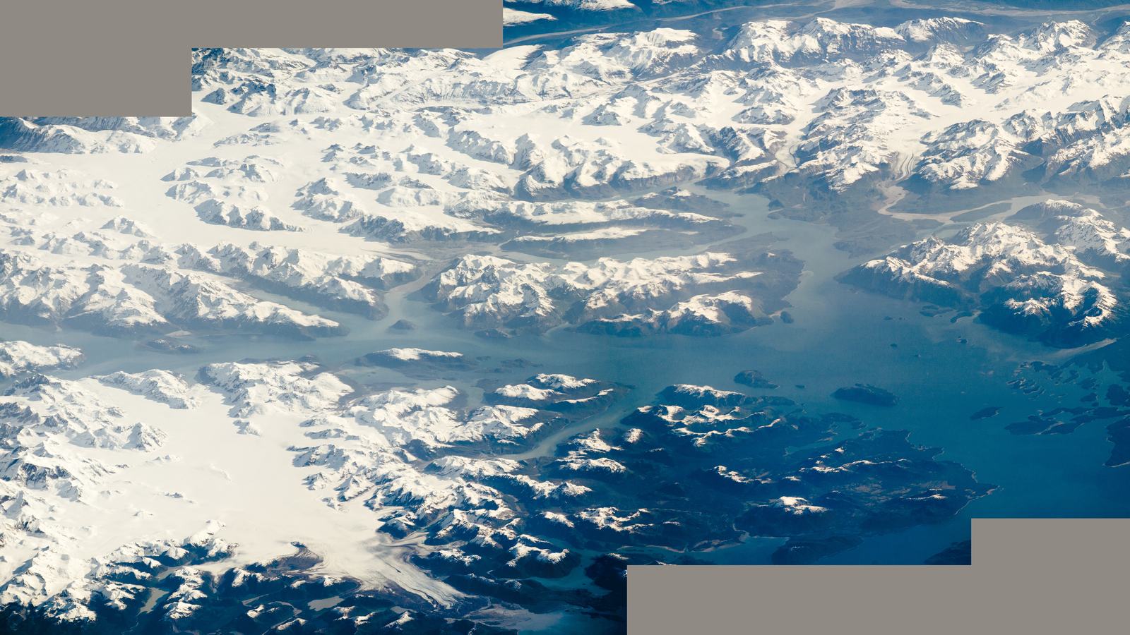
The accompanying official image of Glacier Bay was acquired by an astronaut aboard the International Space Station in May 2016 and released through NASA Earth Observatory. It illustrates the scale and geography of the setting, not current ice conditions or the visibility a yacht should expect in October 2026. Navigational decisions must be based on contemporary charts, notices, forecasts and direct observation.
A better measure of a successful visit
A satisfying superyacht programme in Glacier Bay is not measured by how near the hull comes to a glacier or how many shore stops guests accumulate. It is measured by a well-informed crew, an appropriate permit, careful wildlife separation and enough time to absorb a remarkable place. The result can feel exceptionally private precisely because the park’s restrictions protect the qualities that make it special.
For a summer itinerary, begin with the National Park Service’s current private boating guidance, check the permit portal and orientation requirement, review Whale Waters notices and discuss commercial questions directly with the authority. That work should precede any final guest brochure. An Alaska yacht cruise at its best combines serious seamanship with a willingness to let the wilderness set the agenda.