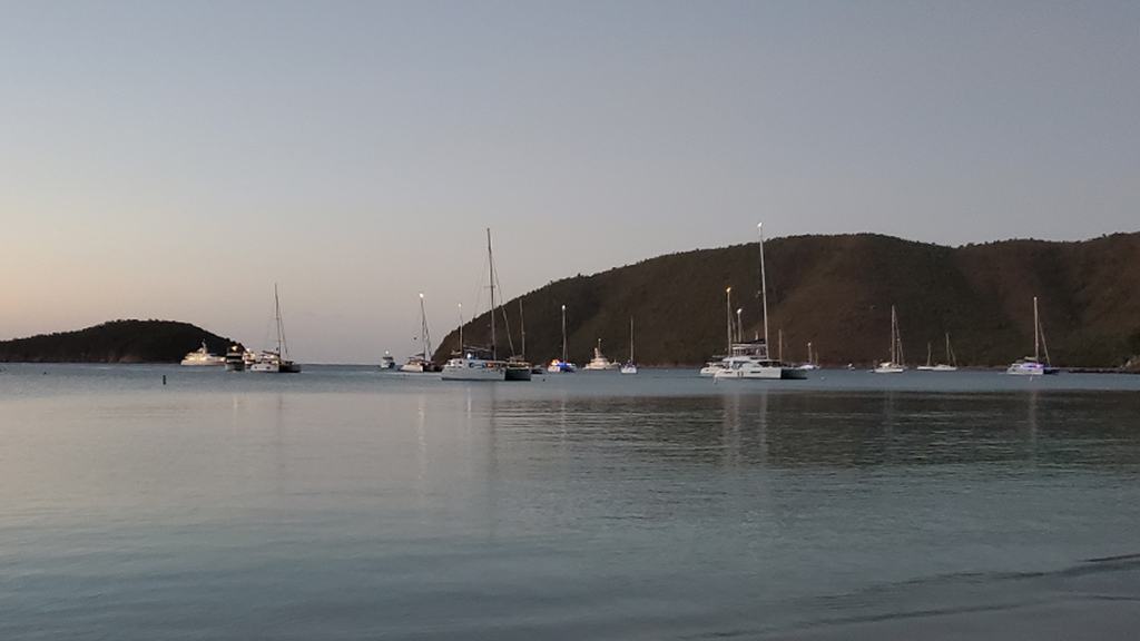
An authoritative St John superyacht itinerary and operational guide: the current NPS size limits for private and charter yachts, Francis Bay anchorage, big-boat moorings, turtle bays and Hurricane Hole.
A Caribbean park with unusually specific limits for large yachts
St John is one of the Caribbean's most compelling destinations for a superyacht: forested hills drop into quiet bays, turtles feed over seagrass and a succession of sheltered shores creates an unusually intimate landscape. Virgin Islands National Park protects much of this coastline, while the adjacent Virgin Islands Coral Reef National Monument includes particularly sensitive marine habitats. The most useful way to experience it from a yacht is to plan around the protection rules instead of assuming that an attractive cove is an available anchorage.
The National Park Service's 2026 superintendent's compendium draws precise boundaries between different vessel lengths, between private and commercial operations, and between ordinary anchoring and the exceptional storm-berth regime at Hurricane Hole. For a captain, those distinctions affect where the yacht may stop, whether a park mooring is available, what a tender may do and whether a proposed overnight programme is realistic. They should be checked against the current official marine map and any fresh notices immediately before arrival.
Begin with the length overall written on the vessel's papers
A useful first question is not simply whether the yacht is longer than 24 metres but exactly how long it is in feet, including the length overall used by the Park Service. Its 2026 rules recognise small-boat facilities, a 61-to-100-foot mooring category, anchorages for 101-to-125-foot vessels and a different framework for private yachts between 126 and 210 feet. Mooring colours and anchor coordinates matter as much as the name of the bay.
These categories must not be treated as estimates for a large vessel. A 30-metre yacht is close to the threshold where ordinary smaller craft moorings cease to apply, while a 50-metre yacht faces a very different set of anchoring possibilities. Bridge teams should use confirmed official LOA and a current park chart, then verify draught, swing radius and commercial status before putting a position into the passage plan.
The 210-foot ceiling is a substantive restriction
The 2026 compendium prohibits vessels longer than 210 feet overall from anchoring or mooring in park waters. It also says those yachts must be making way, rather than merely holding position with engines running. This is particularly relevant to guests aboard very large superyachts who see Francis Bay or Maho Bay from afar and imagine the mother vessel can simply remain in place during an excursion.
An owner of a yacht above that limit can still be interested in St John's beaches, culture and marine life, but the visit requires a suitable berth or anchorage outside restricted park waters and a separately assessed tender transfer. That is an itinerary-planning consideration, not a technicality to be resolved on arrival. The captain must also account for weather exposure, passenger transfer conditions and the legal limits applying to the chosen transfer craft.
Commercial yachts face a stricter threshold
The same compendium sets a separate rule for commercial vessels more than 125 feet overall: they are prohibited from anchoring, mooring or using stationary positioning systems within the park and monument waters. The distinction can be decisive for a large charter yacht whose dimensions might otherwise appear to fall within an allowance given to a private yacht.
Operators should never assume that a general anchorage permission for privately operated craft extends automatically to a commercial charter programme. The vessel's legal operating status and intended activity need to be considered together, particularly where a vessel is under charter during the voyage. Any ambiguity should be resolved directly with the park authority before committing guests to a published itinerary.
Private yachts of 126 to 210 feet: Francis Bay is conditional
For private vessels in the 126-to-210-foot bracket, the compendium provides a designated anchoring opportunity at Francis Bay, but it is highly specific. The permitted area is over sand seaward of the mooring fields at depths greater than 50 feet, more than 300 feet from any park buoy, and east of a specified north-south line drawn from Mary Point to America Point. These are cumulative location conditions, not alternative suggestions.
Such vessels cannot use National Park Service mooring buoys. Stationary positioning is allowed for eligible private vessels in the designated Francis anchorage, but only within the applicable rules. Before arrival the captain should compare charted depth and seabed data with park maps, plan for weather and nearby traffic, and make a final visual assessment of the bottom where practicable. A navigationally convenient spot is not automatically a permitted one.
Lind Point and smaller large-yacht categories
The 2026 provisions designate Lind Point as an anchorage for qualifying vessels up to 125 feet overall, while Francis and Maho Bay may receive vessels up to 210 feet subject to the specific vessel-class requirements. The rules for 101-to-125-foot yachts restrict their anchoring to the Francis and Maho designated area or the mapped Lind Point box; they do not authorise indiscriminate anchoring beside other beaches or buoys.
Vessels between 61 and 100 feet normally use the designated larger-vessel park moorings. Those buoys are purple and marked for that length range, with a limited number available in bays such as Lind Point, Francis, Maho, Hawksnest and Leinster. Eligible vessels may use the authorised Lind Point or Francis-Maho anchorages as provided by the park's rules. Mooring occupancy, condition and permissible overnight use must be checked rather than presumed.
Hurricane Hole is not an ordinary superyacht storm refuge
The name Hurricane Hole can be misleading for larger yacht operators. The national monument does not permit ordinary recreational anchoring there. Under the 2026 compendium, use of its storm-berth system is an exception tied to a current free permit, renewal requirements and the superintendent's formal decision to open the refuge ahead of an approaching storm.
Critically, that storm system was designed for vessels up to 60 feet overall, with a finite number of berths. The park's April 2026 permit announcement required applications by mid-May for that season, with renewals for existing holders. A superyacht over 24 metres cannot reasonably include Hurricane Hole on its heavy-weather refuge list. The sensible response is advance routing to a suitable authorised harbour outside the monument, not an assumption that a sheltered mangrove bay will be available in an emergency.
Why ordinary moorings are not a hurricane plan
National Park Service moorings in these waters are intended for normal visiting conditions, not for riding out tropical storms. The compendium states that the mooring infrastructure is rated for winds below 40 miles per hour and restricts their use, along with use of park anchorages, when severe weather threatens. Historic storm damage is a sobering reminder that an apparently enclosed bay is not equivalent to a certified cyclone berth.
Captains preparing a late-summer or autumn Caribbean cruise should establish a real escape strategy, including forecasts, sea room, landfall options and enough time to move before the weather deteriorates. The plan should also consider whether the vessel can safely continue at sea and what facilities are actually available elsewhere. An appealing anchorage in settled weather is never a substitute for a professionally reviewed tropical-weather response.
Tender routes, swim zones and a quieter guest experience
Once the mothership's legal and safe location is established, the most rewarding moments often take place by tender. Maho Bay's seagrass meadows attract grazing sea turtles, while nearby park shorelines offer calmer views of beaches and woodland. The Park Service identifies protected swim areas and special-use features on its interactive marine visitor map; operators must respect these rather than treating the whole shoreline as a beach-landing zone.
Guests can see more by slowing down. Tender drivers should manage speed and wake around mooring fields and swimmers, confirm any authorised dinghy landing locations and avoid shallow coral or seagrass on approach. Snorkellers should maintain distance from turtles and rays, avoid standing on reef structure and never touch or pursue marine animals. The most memorable encounter is one that leaves no trace.
Marine conservation rules change the boat-handling plan
The park compendium and boating guidance treat anchoring damage as a central management concern. Where anchoring is specifically permitted, the anchor and its chain must be kept off coral and placed on suitable sand. Anchoring in closed areas or around reef and seagrass beds can damage habitats that took decades to develop. The use of an electronic positioning system is not a universal exemption from environmental restrictions.
Underwater lights are also restricted in park and monument waters, a potentially unexpected provision for yachts equipped with decorative hull lighting. Navigation watches should review lighting, water-sports activity, waste handling and shoreline access before guest operations begin. A vessel with sophisticated equipment still has to comply with the rules applying to every other craft, whether or not those systems are standard in another cruising region.
Overnight arrangements and guest logistics
The 2026 park requirements call for an overnight fee when a vessel uses a permitted park mooring or anchorage during the specified evening-to-morning period. The park encourages payment via the recreation.gov system and provides official guidance on how to make payments at approved stations. A paid fee, however, does not create an anchoring permission where vessel size or zoning makes the location off limits.
For a high-service expedition, the purser and captain should coordinate the fee method, guest arrival window and tender trips early. Charter status deserves a separate check, as do any proposed commercial guiding or activities requiring park permits. Local arrangements can change and network service may be imperfect, so the vessel should carry the current official instructions and an alternative communications plan.
Build a St John itinerary that respects the sea
An effective visit could pair a correctly positioned private yacht at a permitted anchorage with early tender excursions to Maho's turtle habitat, guided interpretation of the island's history and a quieter afternoon observing the Caribbean landscape from the water. The day should have flexibility for changing trade winds, anchorage crowding and the comfort of guests moving between a large yacht and a smaller tender.
The wider Virgin Islands offer abundant alternatives for vessels that do not qualify for park anchoring or mooring. The premium experience lies in thoughtful navigation, exact paperwork and a willingness to travel a little farther for the right berth. Official park regulations, not the marketing appeal of a famous bay, should govern the final decision on every overnight stop.