dsnm Presents Compass Navigation Software for Superyacht Chart Corrections and Passage Planning
By Superyacht Guide Newsroom · Edited by Superyacht Guide Newsroom
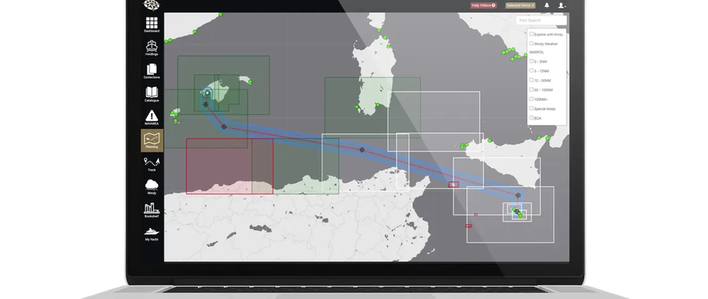
dsnm Compass superyacht navigation software genuine manufacturer product display METSTRADE 2026
dsnm presents Compass software for superyacht chart corrections, passage planning, i4 Insight C-Map overlays and digital cruising publications at METSTRADE 2026.
British superyacht navigation specialist dsnm is presenting its Compass software in the official METSTRADE 2026 Superyacht Zone catalogue, drawing attention to the routine chart-management work that underpins safe passages. The published product description brings several related functions into one proposed workflow: corrections for paper and digital charts, passage planning, overlays on i4 Insight C-Map Professional+ charting and access to electronic publications and cruising guides. These activities are especially important on superyachts that move between jurisdictions or undertake extended itineraries with rotating bridge personnel. The listing establishes the advertised functions, not the correctness of any individual chart update or the regulatory acceptability of a particular installation. It also should not be confused with a new product launch: the relevant news here is the company's 2026 exhibition presentation and what its offering means to professional navigators.
Yacht guests typically judge a voyage by its destinations and comfort, while deck officers perform an extensive preparation process long before departure. Chart coverage must be checked, navigational warnings consulted, passages reviewed and the bridge equipped with the information needed for likely alternatives. This task can be demanding for a vessel that changes itinerary at short notice. A luxury yacht may move from familiar Mediterranean waters to a remote cruising area, where the information available to a bridge team differs considerably from that used on a normal seasonal route. A chart-management package can help coordinate these tasks, provided officers still understand and verify the original data. The software is an aid to an established navigational procedure, not a replacement for the navigator's responsibility to evaluate sources and local conditions.
The official METSTRADE listing describes Compass as superyacht navigation software designed for everyday use aboard large yachts. Its named components include regular paper and digital chart corrections, passage-planning tools and overlays for i4 Insight C-Map Professional+ charts. The company also refers to digital publications and cruising guides. These are separate functions, each requiring a different assessment during procurement. Chart correction is about maintaining information, passage planning concerns the intended route and its risks, and cruising guides can provide background on facilities or practices at destinations. An owner or captain should ask for a demonstration of each component and its intended place in the yacht's bridge workflow. The exhibitor description does not state that a single program removes the need for other approved charts, publications or navigation systems.
Where a yacht uses paper nautical charts, their usefulness depends on whether they contain the latest applicable official corrections. The complexity extends beyond marking a hazard: officers need confidence that the correct chart edition is aboard, that relevant notices have been processed and that the correction record can be audited. Compass advertises regular chart correction as part of its offering, but the navigation team should establish how updates are received and how they are applied. Are correction instructions generated for the precise chart edition held onboard? Who confirms completion and how are outstanding notices recorded? A well-run process also provides a check when officers change during a voyage or hand over between rotations. Technology should make those questions easier to answer rather than hide them behind an apparently reassuring status indicator.
Electronic charting has made it easier to distribute updated information, but digital availability does not guarantee universal coverage or eliminate differences between data sources. The bridge team still needs to establish which chart product is being used, its licensing conditions and the update status for each intended cruising area. Compatibility with a planning tool is different from compliance with applicable navigational carriage requirements. If Compass displays a useful overlay on C-Map Professional+ material, officers should know precisely what the overlay represents, its age and the authoritative source behind the information. They should also understand how an update is checked after installation. A major risk of integrated systems is that visual convenience can obscure differences in data quality. Clear source references and visible revision dates help prevent a polished interface from acquiring more authority than the underlying information deserves.
Passage planning is not simply a sequence of waypoints connected across a chart. The navigator must consider the vessel's draft, air draft, manoeuvring characteristics, expected weather, available sea room and potential refuge locations. A superyacht with substantial freeboard or deeply immersed stabiliser fins may have different operational constraints from a small recreational vessel using the same stretch of water. Local traffic measures, restricted areas and seasonal regulations may also affect route decisions. A software workflow can provide a structured place to organise these details, but it needs accurate vessel-specific inputs and careful checking. Captains should be wary of a route that appears convenient on a display yet lacks sound justification for critical legs. Human review and bridge team briefings remain indispensable, irrespective of how sophisticated the planning interface becomes.
The Compass catalogue includes digital cruising guides and publications, which can be valuable for destination research. A guide may describe arrival procedures, a harbour's general character or the practical limits of local facilities. Such information helps owners and crews anticipate the services available during a private itinerary or charter. It should not, however, be treated as a navigational chart or a guarantee of present berth conditions. Marina depths can change, rules may be updated and an attractive anchorage can become unsuitable in particular weather. Officers should verify crucial operational decisions through current authoritative notices and direct communication with relevant local providers. Presenting guides alongside charting can save time, but only if users understand that different forms of content carry different responsibilities and levels of currency.
A larger yacht may have several qualified navigators who prepare, review and execute passages at different times. Shore-based management and itinerary teams may also want to understand the proposed route without having control of the live navigation system. A navigation software package can help standardise documents and terminology, subject to how its sharing functions are actually implemented. The essential questions are procedural: which officer prepares the plan, who checks it, who approves it and what happens after a route changes? A clear revision history is valuable when an owner requests a new destination or weather requires a diversion. Crews should avoid maintaining competing versions of a passage plan in email attachments, local computers and separate tablets. Where integration helps, it should support a documented chain of responsibility rather than create another channel of uncertainty.
The manufacturer's listing expressly names overlays on i4 Insight C-Map Professional+ charts. Buyers should ask the company to identify which data layers are available, how they are updated and whether a vessel needs additional licences or subscriptions. An overlay might be relevant to planning or situational understanding, but the presence of data in a software layer does not establish how it should be used during live navigation. The bridge team should test legibility, scaling and what happens when one layer is removed or unavailable. Displays that become crowded with too much supplementary material can distract rather than inform. It may be sensible to reserve some information for pre-passage planning instead of showing it continuously during the watch. A deliberate division between planning data and live bridge information helps preserve the clarity that navigation demands.
A superyacht may lose a reliable internet connection or encounter subscription and authentication problems while far from its usual home port. Software procurement should therefore investigate what functions remain usable offline and whether the installed charts or publications have an appropriate fallback arrangement. The METSTRADE product page does not provide a definitive offline-service specification, so this point must be confirmed with dsnm. Officers should know the difference between a failed download and a data product that is merely awaiting the next scheduled update. A practical contingency plan identifies which essential documents are already stored aboard and how the bridge can continue an approved navigation procedure without a functioning secondary computer. Robustness is not solely a technical specification; it is the combination of a supportable system, current data and a crew that knows how to respond to disruption.
Large yachts can experience frequent changes among watchkeeping officers, particularly in charter operations and where seasonal patterns require different personnel. A software platform that only one crew member can use confidently may become a liability. Familiarisation should cover the same routine tasks each officer expects to perform: identifying missing chart updates, preparing a plan, reviewing corrections and locating a publication. Training should also explain error states and the meaning of each update status, because false confidence can be more dangerous than a plainly incomplete task. Written procedures should state when information must be corroborated with official sources and how a relief officer can check the vessel's current navigation readiness. Ease of use is important, but it should not be measured solely by the speed of a demonstration at a trade show.
The company has been in the industry news for its wider business development, including the acquisition of NavigatX. Compass is a separate editorial subject focused on the actual navigation workflow described in the 2026 exhibition catalogue. The two stories should not be conflated: an acquisition may change an organisation's market reach, but does not automatically establish new functions or performance within an existing software product. Readers interested in the navigation system need practical detail about chart correction, route preparation and publications, rather than assumptions about product integration following an ownership change. That distinction also helps an owner compare the software with other services on a like-for-like basis. The proper benchmark is whether the advertised workflow solves a real navigation-management problem aboard the particular yacht.
Following METSTRADE, a captain evaluating Compass could ask the supplier to work through a representative voyage using the yacht's actual chart inventory and a realistic destination. The demonstration should reveal how a changed chart is identified, how a correction is tracked, how an electronic publication is accessed and how a route can be revised and reviewed. Procurement discussions should also cover supported chart formats, update frequency, current software requirements, licensing and access to technical support during overseas cruising. Details not included in the exhibition listing should be treated as open questions until documented. A clear answer to those questions would place the product in the context of everyday bridge operations, where staff time, accountability and information quality determine value.
Superyacht navigation combines professional seamanship with the administrative discipline needed to keep a changing set of charts and publications current. dsnm's advertised Compass package is relevant because it seeks to organise several of those recurring tasks within one workflow. The objective for a yacht owner is not to eliminate the navigator's work but to reduce avoidable confusion and help officers verify what is ready for a safe passage. For captains and technical managers returning from METSTRADE 2026, the Compass listing offers a focused basis for asking how chart correction, passage planning, compatible overlays and digital publications can work together, with the ship's approved navigation procedures remaining firmly in control.
Primary source: dsnm Ltd — official METSTRADE 2026 Compass navigation software product listing.
Manufacturer software product image: dsnm Ltd Compass navigation application as published in the official METSTRADE 2026 catalogue. Official source.
Explore
Go deeper into the yachts, companies, events and destinations directly connected to this article.
Continue reading
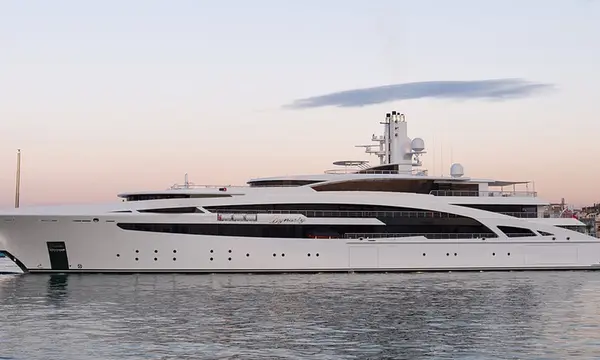
Cramm Yachting Systems details stainless-steel telescopic navigation-light masts for superyachts, with flush deck retraction and managed cables at METSTRADE 2026.
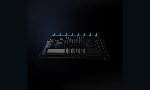
Eagle Marine presents a modular ADAS platform combining cameras, onboard computing and third-party applications for yacht navigation and docking assistance.

Superyacht navigation specialist dsnm has acquired sister company NavigatX, bringing navigation management, passage-planning software and bridge refit support together.

Avikus USA executive Sangwon Shin is discussing how sensors, steering, propulsion and AI need to operate as one system for future assisted superyacht navigation.
Superyacht Guide
Continue into the wider Superyacht Guide.
Business opportunities · Superyacht Guide
Companies serving the superyacht market can discuss clearly identified advertising, sponsorship and business-profile opportunities. Commercial activity remains separate from independent editorial coverage.
